
Hydrogeological model LAMO
Information about the model LAMO
Hydrogeological models (HM) are being developed for the management of state groundwater resources, environmental protection and the study of natural processes. Scientists of Riga Technical University (RTU) Environmental Modeling Centre (VMC) have developed two HM of Latvia: REMO (Large Riga) since 1993. until 1996 and LAMO from 2010 by 2015.
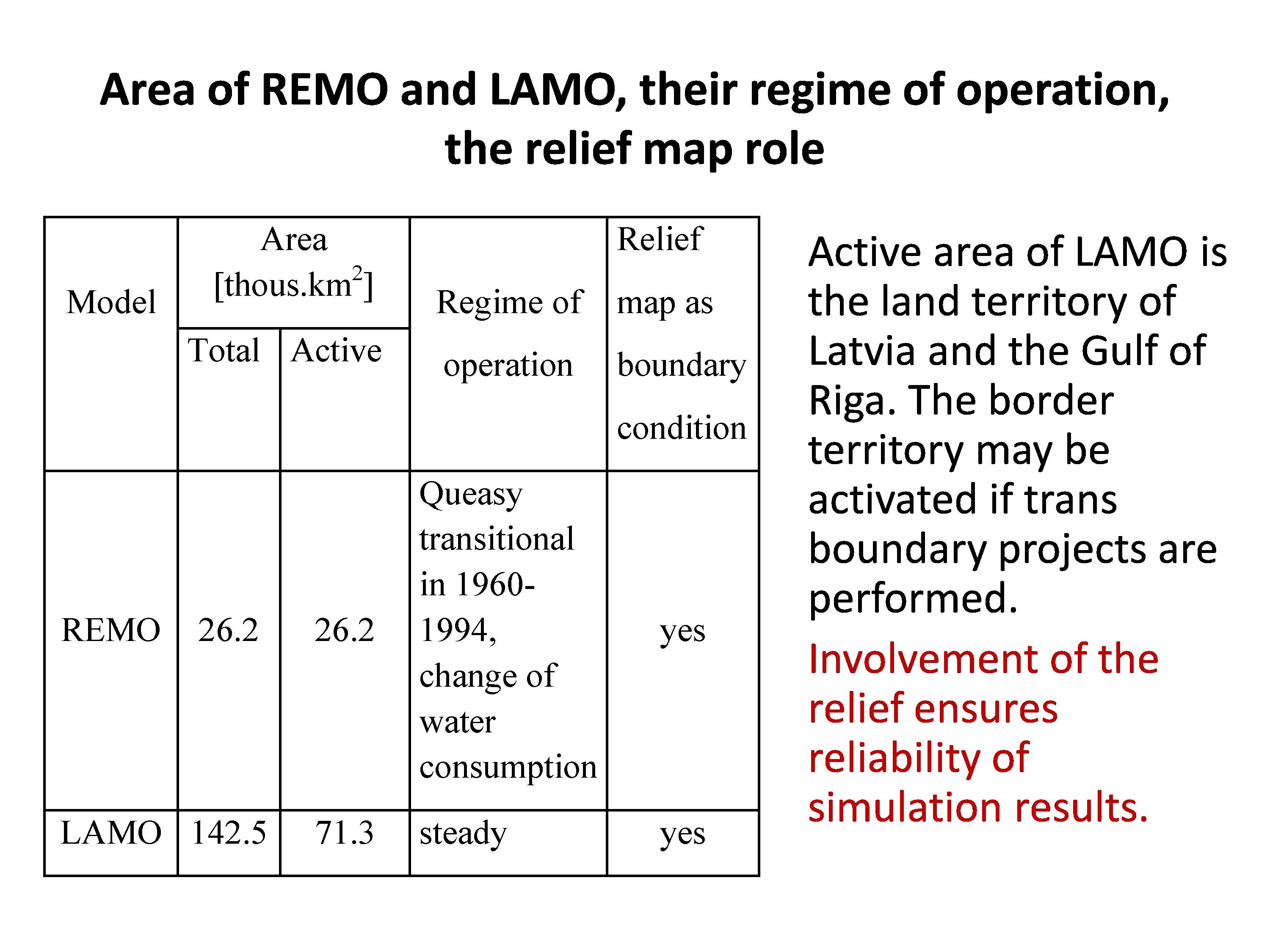
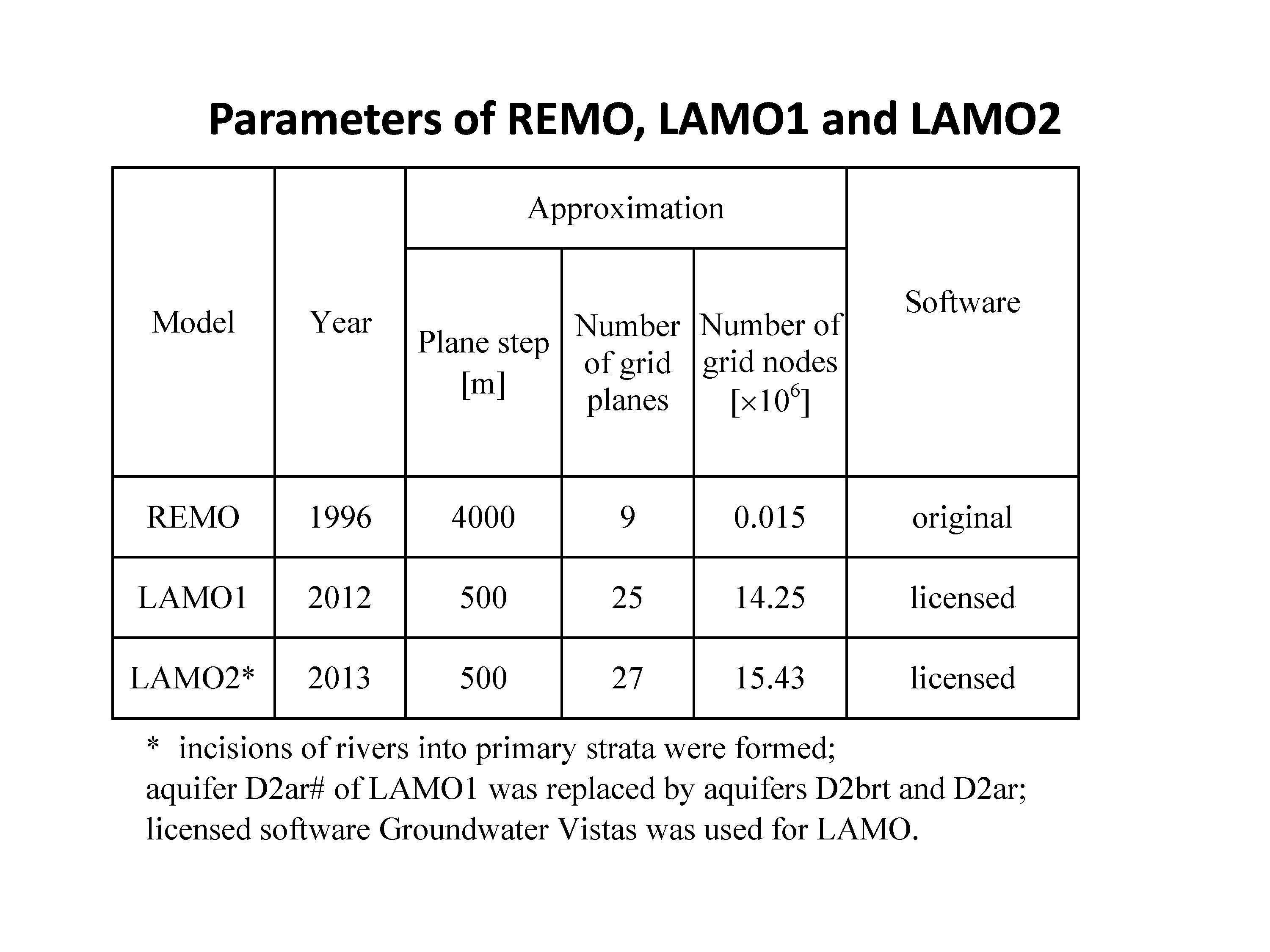
REMO included the central part of Latvia, its plane approximation step was 4000 m. LAMO operates throughout Latvia. In the first version of the model LAMO1, the plane approximation step was 500 meters.
The HM version LAMO1 (2010-2012) was implemented as an ERDF project and LAMO2 (2013) as a RTU funded study. Versions LAMO3 and LAMO4 have been created in the framework of the National Research Program EVIDEnT.
At present, the most complete version of LAMO4 is a data source on the geometry and filtration properties of geological layers, groundwater levels and flows, and on the interaction of groundwater with surface water (rivers, lakes, sea).
Location of LAMO and REMO
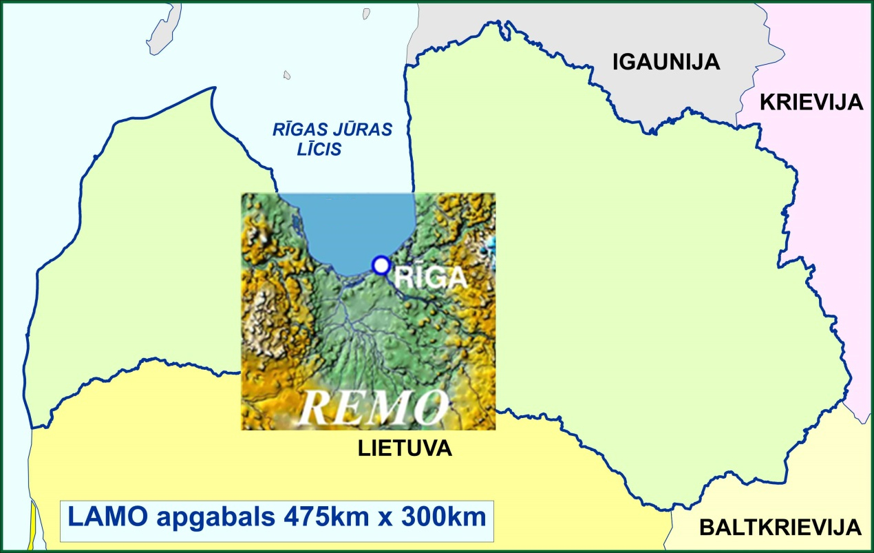
All versions of LAMO have been presented for approbation in Latvian Environment, Geology and Meteorology Centre (LEGMC).
LAMO model:
- describes the average hydrogeological conditions in Latvia;
- simulates the active groundwater zone;
- uses the Groundwater Vistas (GV) tool MODFLOW; the movement of different substances in groundwater can be modeled by the GV programs MODPATH and MT3D.
Initial data of LAMO
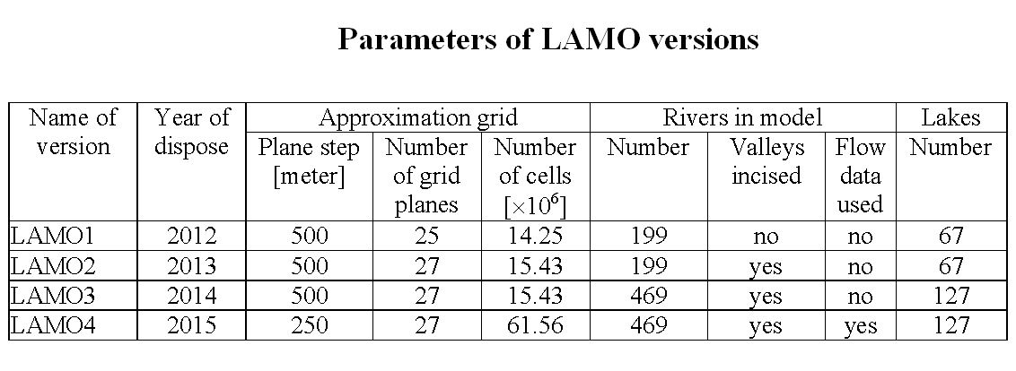
LAMO2, LAMO3 and LAMO4 have 14 aquifers that are linked by 13 aquitards. The structure of geological layers is determined by their surface (z-maps) and filtration properties (k-maps). These maps were created using LEGMC data of boreholes, surfaces and geological layers and their borderlines.
Information on the digital relief of the model, data on the largest 469 rivers and 127 lakes were obtained from the materials of the Latvian Geospatial Information Agency.
LAMO calculates:
- groundwater levels in 3D grid nodes (φ-maps);
- groundwater streams (q-maps) and their velocity (ν-maps);
- groundwater inflows in rivers and lakes;
- groundwater flow balances.
More information about the LAMO and available data are in latvian version of this page.